
Vineyard Barn Documentation
Hamptons Custom Home Builder · McLoughlin Construction Corp
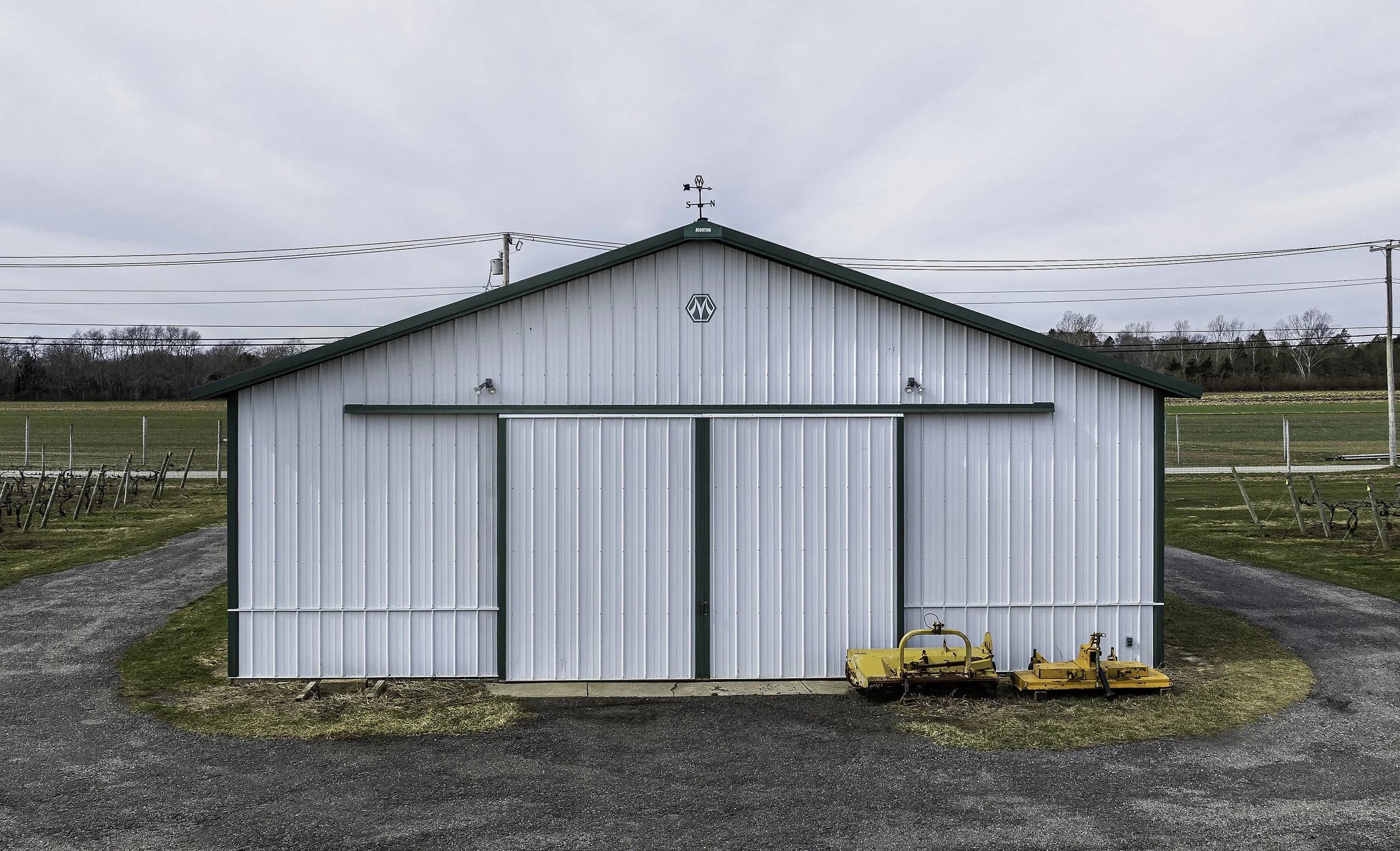
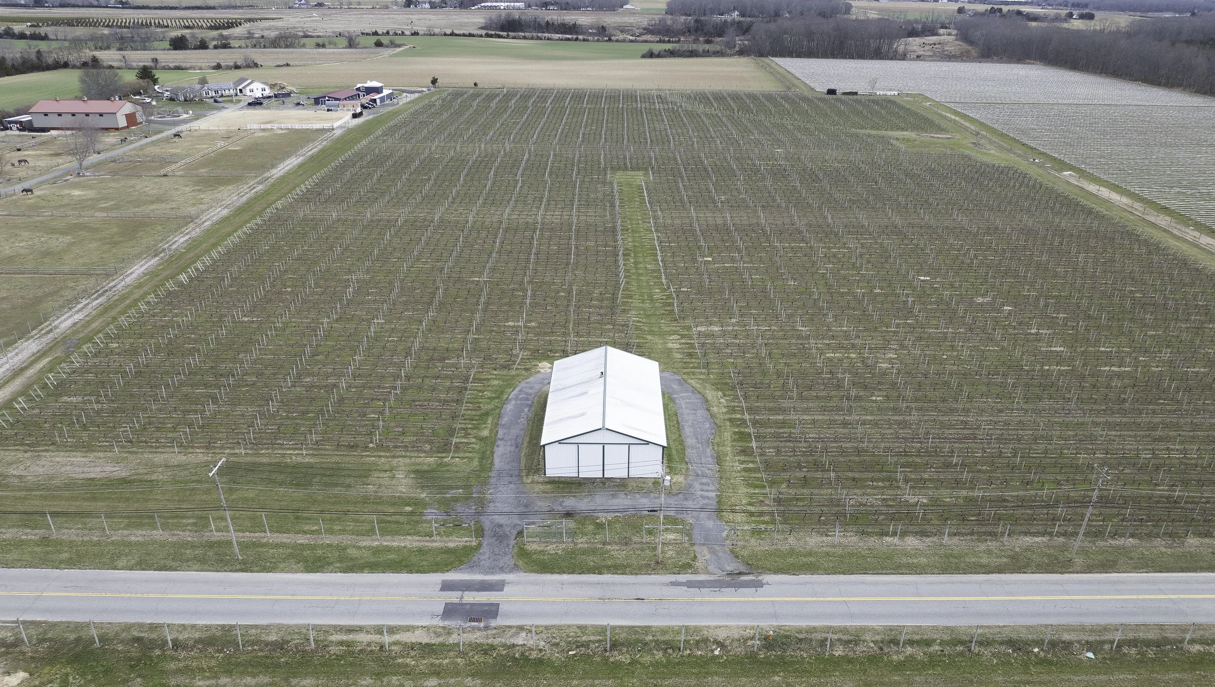
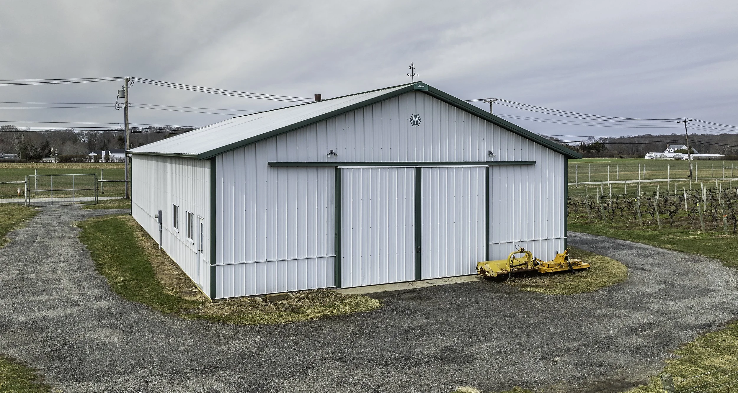
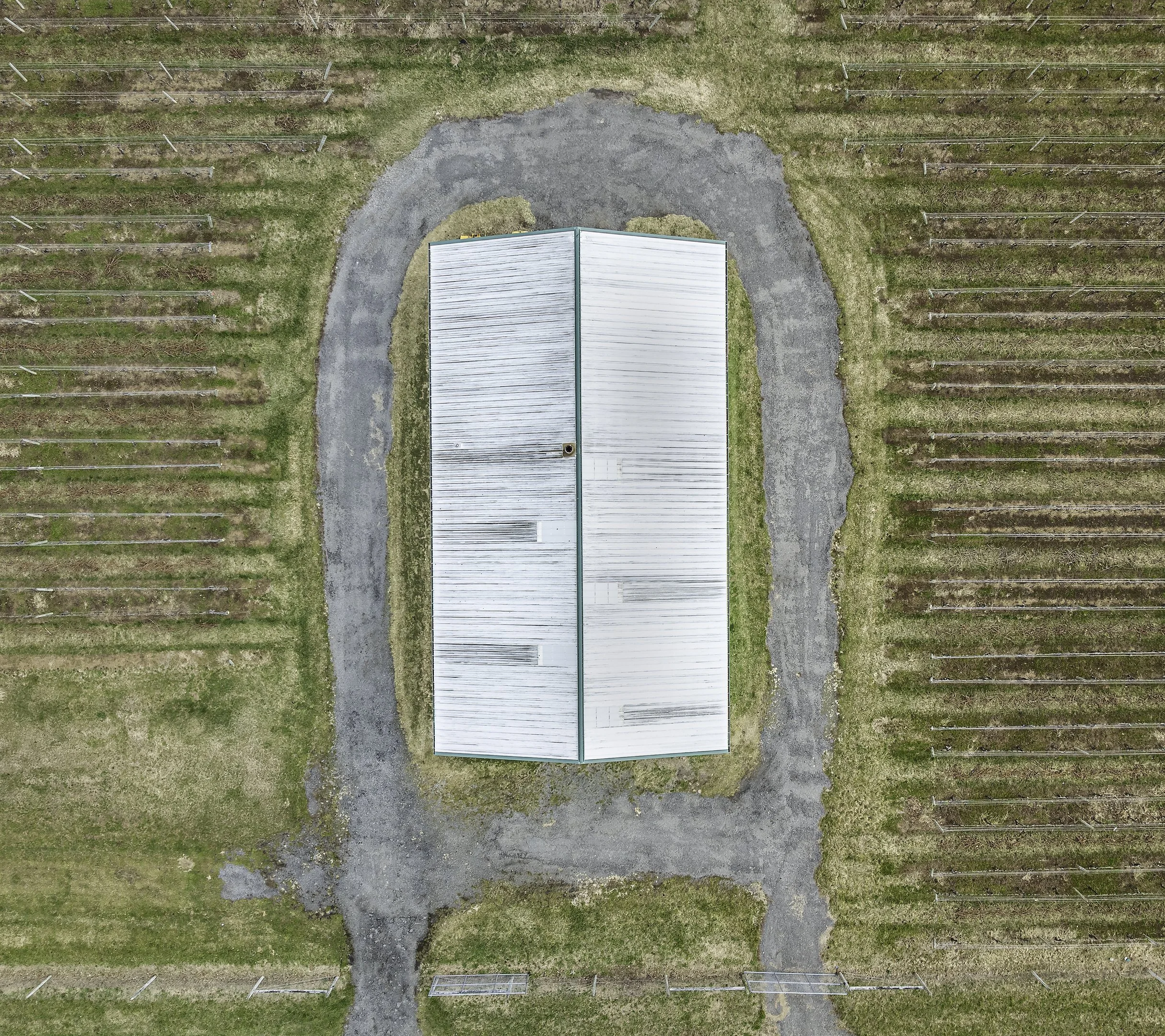
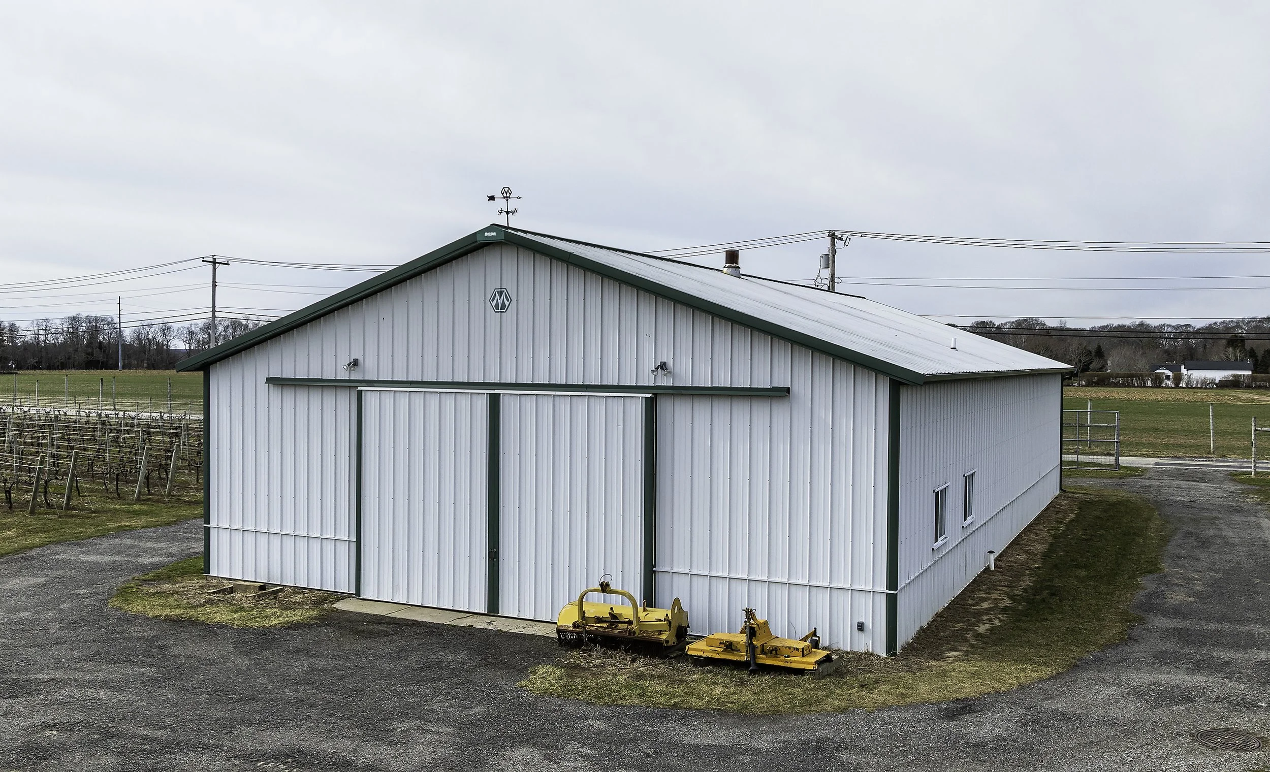
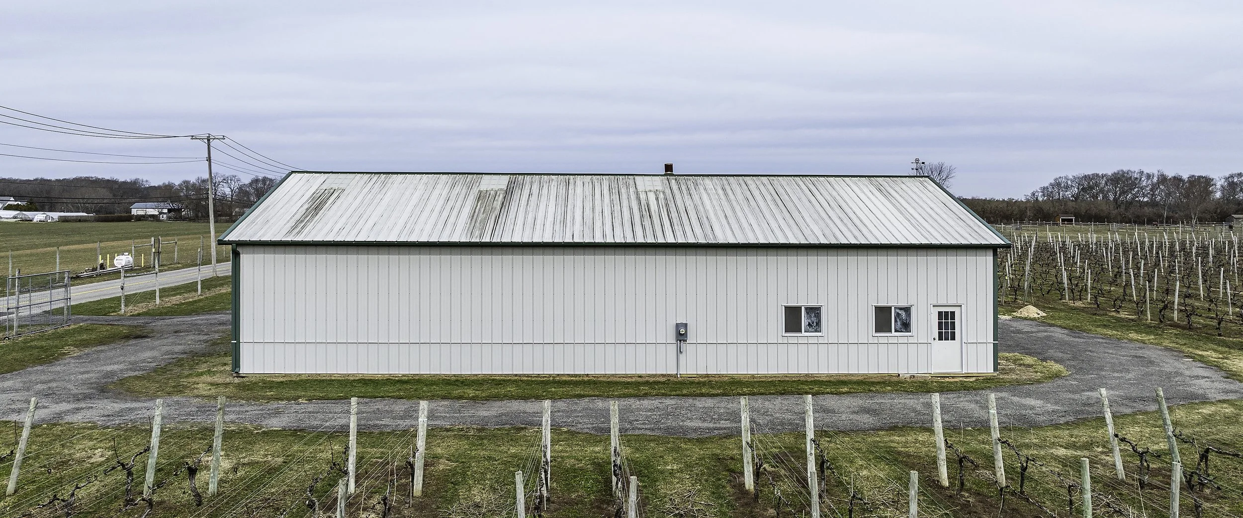
This project involved documenting an existing agricultural barn located within an active vineyard to support a renovation bid for McLoughlin Construction Corp. The objective was to capture clear, accurate visual information that would allow McLoughlin Construction Corp to assess the structure, understand site conditions, and effectively present the project to their stakeholders. A combination of aerial drone photography and ground-level perspectives was used to document the building's elevations, surrounding landscape, access points, and overall spatial relationships within the vineyard. The final image set provides a comprehensive visual record, enabling McLoughlin Construction Corp to communicate the scope and context of the proposed remodel with clarity and precision.
Every Angle Documented With Precision
Whether it's a renovation bid or a site assessment — we give you the visual record you need to move your project forward.
From aerial overviews to ground-level elevations — this documentation gave the client everything they needed to assess the structure, present the project to stakeholders, and move forward with their renovation bid with confidence.