
Construction Drone Photography & Aerial Documentation in NYC
Professional drone photography and aerial documentation for architects, builders, and construction companies across New York City, Long Island, and North New Jersey.
From groundbreaking to project completion — I capture scale, context, and spatial relationships from above that ground-level photography simply cannot provide. Every flight is planned, every frame is intentional.
I specialize in construction drone photography, progress documentation, and aerial imaging for contractors, developers, and architects.
Drone operations within New York City require a municipal permit application. A non-refundable $150 fee applies, paid at booking, with a minimum 30-day advance notice required. I handle the full permit process — you just need to plan ahead.
Aerial Documentation
in Action
A look at how I document construction projects, architectural sites, and development progress from above — across NYC, Long Island, and North New Jersey.
Construction Drone Services
Aerial Photography
High-resolution aerial stills that give builders, architects, and developers a perspective no ground-level camera can — capturing scale, context, and site relationships across New York.
Aerial Video
Cinematic drone video for project milestones, construction progress reporting, and client presentations — giving your work the visual storytelling it deserves.
Construction Progress & Site Documentation
Recurring milestone documentation from groundbreaking through completion, paired with contextual aerial views of the site and its surroundings — giving builders, developers, and architects a complete visual record at every stage.
Before & After
Aerial drone documentation capturing the full arc of a construction project — from groundbreaking to completion. Delivered to builders, developers, and architects across NYC, Long Island, and North New Jersey.
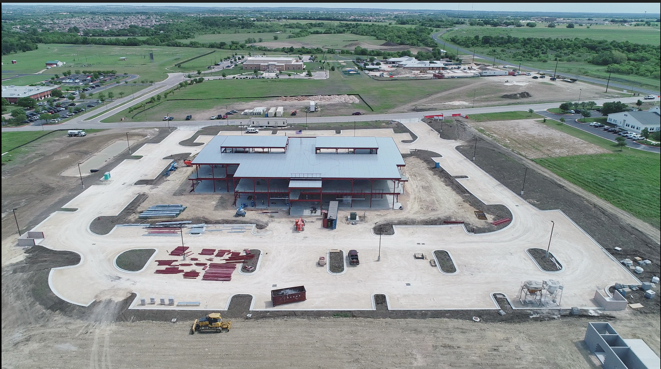 Before
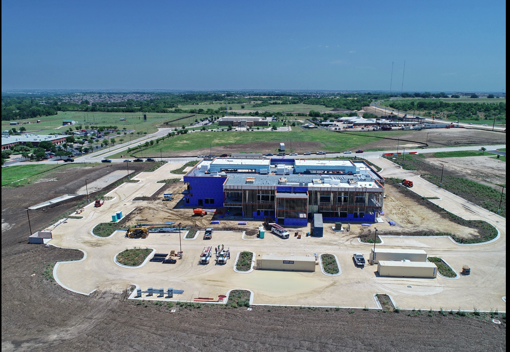 After
After
NYC · Long Island · North New Jersey
New York City
- Manhattan
- Brooklyn
- Queens
- Bronx
- Staten Island
Long Island
- Suffolk County
- Nassau County
- The Hamptons
- Great Neck
North New Jersey
- Jersey City
- Hoboken
- Newark
- Fort Lee